Datei:Map Hen Ogledd.jpg
Zur Navigation springen
Zur Suche springen

Größe dieser Vorschau: 501 × 599 Pixel. Weitere Auflösungen: 201 × 240 Pixel | 800 × 957 Pixel.
Originaldatei (800 × 957 Pixel, Dateigröße: 338 KB, MIME-Typ: image/jpeg)
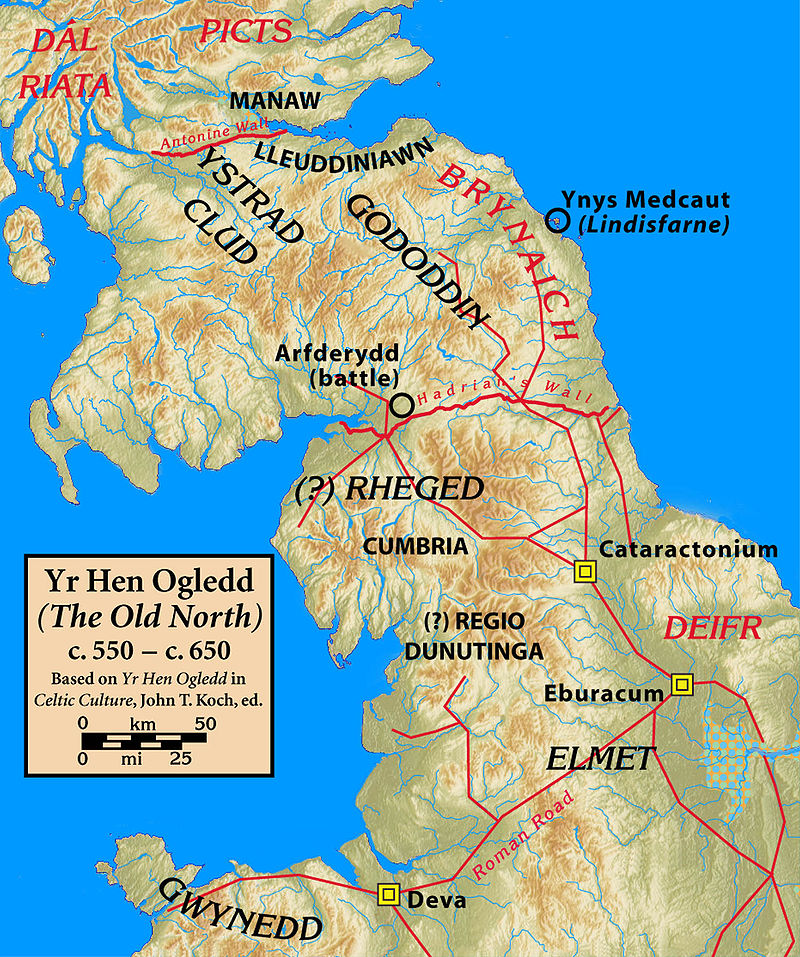
Von myself - placements of peoples and sites based on Celtic Culture: A Historical Encyclopedia, John T. Koch, ed. (2005), isbn 9781851094400, except that positioning of Roman roads is based on the Iter Britanniarum of the Antonine Itineraries and other sources, supplemented by Koch's additions., CC BY-SA 3.0, https://commons.wikimedia.org/w/index.php?curid=7547119
Dateiversionen
Klicke auf einen Zeitpunkt, um diese Version zu laden.
| Version vom | Vorschaubild | Maße | Benutzer | Kommentar | |
|---|---|---|---|---|---|
| aktuell | 14:39, 20. Okt. 2016 | | 800 × 957 (338 KB) | Oteriwutaban (Diskussion | Beiträge) | Von myself - placements of peoples and sites based on Celtic Culture: A Historical Encyclopedia, John T. Koch, ed. (2005), isbn 9781851094400, except that positioning of Roman roads is based on the Iter Britanniarum of the Antonine Itineraries and othe… |
- Du kannst diese Datei nicht überschreiben.
Dateiverwendung
Die folgenden 4 Seiten verwenden diese Datei: