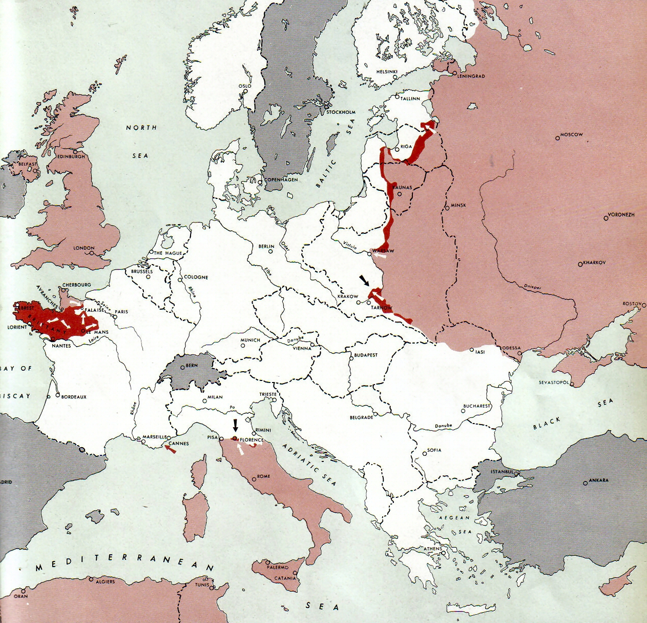
Datei:Map Deutschland 1944-08-15.jpg
Zur Navigation springen
Zur Suche springen

Größe dieser Vorschau: 623 × 599 Pixel. Weitere Auflösungen: 250 × 240 Pixel | 1.263 × 1.215 Pixel.
Originaldatei (1.263 × 1.215 Pixel, Dateigröße: 1,24 MB, MIME-Typ: image/jpeg)
By Army Map Service - Document "Atlas of the World Battle Fronts in Semimonthly Phases to August 15th 1945: Supplement to The Biennial report of the Chief of Staff of the United States Army July 1, 1943 to June 30 1945 To the Secretary of War", Public Domain, https://commons.wikimedia.org/w/index.php?curid=3271960
Dateiversionen
Klicke auf einen Zeitpunkt, um diese Version zu laden.
| Version vom | Vorschaubild | Maße | Benutzer | Kommentar | |
|---|---|---|---|---|---|
| aktuell | 05:52, 29. Mai 2017 | | 1.263 × 1.215 (1,24 MB) | Oteriwutaban (Diskussion | Beiträge) | By Army Map Service - Document "Atlas of the World Battle Fronts in Semimonthly Phases to August 15th 1945: Supplement to The Biennial report of the Chief of Staff of the United States Army July 1, 1943 to June 30 1945 To the Secretary of War", Public… |
- Du kannst diese Datei nicht überschreiben.
Dateiverwendung
Keine Seiten verwenden diese Datei.