Datei:Map Griechenland 1918.png
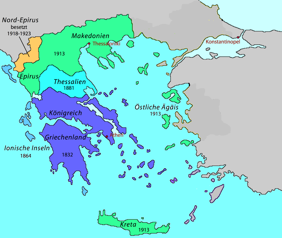
Description: Territoriale Expansion Griechenlands 1832-1947 Date: 27 February 2007 Source: Own work (adaptation of Image:Map Greece expansion 1832-1947-fr.svg, GFDL). Author: Pitichinaccio Permission (Reusing this file) is granted to copy, distribute and/or modify this document under the terms of the GNU Free Documentation License, Version 1.2 or any later version published by the Free Software Foundation; with no Invariant Sections, no Front-Cover Texts, and no Back-Cover Texts. A copy of the license is included in the section entitled GNU Free Documentation License. Die Karte wurde bearbeitet von Oteriwutaban.
Dateiversionen
Klicke auf einen Zeitpunkt, um diese Version zu laden.
| Version vom | Vorschaubild | Maße | Benutzer | Kommentar | |
|---|---|---|---|---|---|
| aktuell | 14:31, 15. Jul. 2018 | | 990 × 836 (225 KB) | Oteriwutaban (Diskussion | Beiträge) | Description: Territoriale Expansion Griechenlands 1832-1947 Date: 27 February 2007 Source: Own work (adaptation of Image:Map Greece expansion 1832-1947-fr.svg, GFDL). Author: Pitichinaccio Permission (Reusing this file) is granted to copy, distribute a… |
- Du kannst diese Datei nicht überschreiben.
Dateiverwendung
Die folgende Datei ist ein Duplikat dieser Datei (weitere Details):
Keine Seiten verwenden diese Datei.